Monday 14 April 2014

Elafius of Caer Gwinntguic (fl. 446 - 447)

Mentioned in Bede's History, Elafius was a British chieftain in the 440s and most likely a leader of the short-lived kingdom of Caer Gwinntguic. He is said to have had a crippled son who was miraculously cured by a visiting missionary, St. Germanus of Auxerre, in c.446.

Bede recorded the events as follows:

"...the wicked spirits, flying over the whole island, were reluctantly compelled to announce to the inhabitants the arrival of St. Germanus. Upon which Elafius, one of the principal men of the country, hastened to meet the holy men, taking with him his son, who, though in the flower of youth, was afflicted with such debility and lameness, as would have moved anyone to compassion to behold him: for the sinews of his legs were so contracted that he could not walk, nor even put his feet to the ground. An immense number of people followed this Elafius, and assembled round the holy prelates...

...Elafius cast himself at the feet of the Missioners, presenting to them his son ... the blessed Germanus ordered the youth to sit down, and, applying his healing hand to the part affected, gently drew it over it, when immediately the contracted sinews were relaxed, and restored to their proper tone, and the young man was presented to his father perfectly cured."

According to Bede, the miracle proved to Elafius that Catholicism was the one true faith, not Pelagianism (a branch of Christianity that rejected the idea of original sin and deemed heretical by the Catholic Church). Whether the events recorded by Bede really happened or not, Elafius and his people converted and shortly afterwards Pelegain preachers were exiled from the kingdom.

Sunday 13 April 2014

Bernaccia / Bryneich

Bernaccia was a British kingdom that was created as part of the division of the Old North after the death of Coel Hen in c.420. With its capitals at Cataractonium (Catterick) and Corstopitum (Corbridge), the kingdom stretched east of the Pennines from the River Tees to north of Hadrian’s Wall. The Britons of Bernaccia were descendants of the southern Votadini tribes and presumably enjoyed peaceful relations with the northern Votadini in Goutodin.

Not much is known about the kingdoms of the North at this time, and Bernaccia is no exception. Its first king is recorded as Gorbanian / Germanianus, a younger son of Coel Hen. Later kings and events are mostly remembered in Welsh myth; many of the tales told about the Old North probably have a basis in truth but they are highly embellished and it is difficult to unpick fact from fiction.

Archaeological evidence suggests that laeti from Angeln were settled along the coast and Hadrian’s Wall by the early fifth century, presumably employed to protect the kingdom from Pictish and Germanic raiders in the dark days of Sub-Roman Britain. In 547, a century after the laeti revolt in Southern Britain, the Bernaccian Angles, led by a warrior named as Ida, revolted and seized the kingdom, kicking out the young king in the process. Morcant Bulc, the last British king of Bernaccia, fled north to Goutodin. Led by Morcant Bulc, a confederation of British kings from North Rheged, Elmet and Alt Clut attempted to retake Bernaccia in 590. They almost succeeded but the assassination of King Urien of Rheged (probably ordered by Morcant Bulc) fatally weakened the British cause and the confederation fell apart. Morcant Bulc died soon after and with him died the British kingdom of Bernaccia. The Anglian settlers called their new kingdom Bernicia and would in time unite with their southern neighbours, Deira, to form the powerful Anglo-Saxon kingdom of Northumbria.

Saturday 12 April 2014

Coel Hen (c.350 - c.420)

Named in Celtic tradition as the High King of Northern Britain, Coel Hen is a prominent figure in many ancient genealogies. Many of the kingdoms of northern Britain and Wales were ruled by his descendants and he is preserved in legend as the founding ancestor of the Men of the North.

With the fading of central Roman administration in the early fifth century, regional governors known as dux were appointed to manage the protection of the island in the face of increasing barbarian raids. Brittania Secunda, the province of northern Britain, was placed into the care of a man named in the genealogies as Coel Hen – Cole the Old. From his headquarters in Ebrauc (York), Coel ruled a huge area of the north which stretched from Ebrauc to Hadrian’s Wall and possibly even beyond into the territory of Goutodin. Very little is known of Coel Hen personally but he must have been a charismatic and determined leader as he managed to turn northern Britain from a province which looked to Rome for its defence to an independent kingdom capable of defending itself.

Coel’s efforts meant that he was regarded as the first King of the North and he is familiar to many of us as Old King Cole from the nursery rhyme. Coel died in around 420 and his death is preserved in Welsh legend. The story goes that during Coel’s time as High King, Scotti settlers from Ulster had settled on the western coast of Pictland. Concerned that the Picts and Scots would join forces against the British, Coel sent raiders across his northern borders to stir up trouble between them. Coel’s ruse didn’t fool anyone and the Picts and the Scots retaliated by attacking Alt Clut. Enraged, Coel and his army stormed north and the Picts and the Scots fled into the hills. Flushed with victory, Coel chased after them and set up camp in what is now Ayrshire. Sometime later, starving and desperate, the Picts and Scots advanced in an all-or-nothing attack on Coel’s stronghold. Taken by surprise, Coel and the northern British scattered in panic. Coel wandered through the unfamiliar countryside of Argyll until he fell into a bog and drowned – an inglorious end for the first High King of Northern Britain.

Mention of Coel Hen in the Y Commrodor genealogy
On his death, Coel’s kingdom was divided between his two sons with the eldest, Ceneu, taking Ebrauc and his youngest, Gorbanian, inheriting Bernaccia. His daughter, Gwawl, had been married off to Cunedda Wledig and the pair had founded a kingdom and spawned several royal dynasties of their own in North Wales. His descendants, the northern British and Welsh kings of the sixth century, would stubbornly resist Teutonic invasion until their calamitous defeat at the Battle of Catreath in 597.

Friday 11 April 2014

Durovernum Cantiacorum

Originally an Iron Age hill fort, Durovernum was a town in the Roman province of Britannia which existed for a period of four hundred years from the time of the Roman Conquest until the arrival of Hengist and Horsa in the mid-fifth century.

Durovernum was founded as a Roman fort in 43 AD, very soon after the conquest, to guard a crossing of the River Stour. Military occupation of the site lasted until 60 AD. After demilitarisation, Durovernum became the civitas capital of the Cantii, a Celtic tribe who inhabited most of modern day Kent. The short period of militarisation and the very early date for the founding of Durovernum (one of the earliest in Britain) reflects the largely pro-Roman attitudes found at that time among the Cantii.

With a strategic position on Watling Street, Durovernum was a prosperous and thriving Roman town. As a civitas, the town would have had a forum, a basilica, temples, a theatre and public baths. The exact locations of many of these buildings are unknown, buried as they are under modern day Canterbury. In the late third century, to defend against barbarian raids, stone walls and a large earth bank were constructed around the town.

Durovernum Cantiacorum in its Roman heyday...
After the Roman withdrawal in around 410, the Romano-British inhabitants of many civitas capitals in Britain attempted to carry on as normal and Durovernum was no exception. It’s not known if Ceint became a true kingdom in its own right in the early fifth century, or if it was a semi-independent province governed by a Roman-style magistrate. Whichever the case, Ceint’s increasing vulnerability to barbarian raids meant Saxon laeti were quickly hired to protect Durovernum in return for land outside of the city walls.

In the 440s, the Romano-Britons of Ceint were hit by a double-whammy; firstly a plague swept across southern Britain in 446; secondly there was laeti revolt soon after in which many of the Saxon and Jutish mercenaries settled around Ceint joined a Germanic army of invaders led by Hengist and Horsa. Chaos ruled across south-east Britain and Durovernum fell in 457.

...and Durovernum Cantiacorum in the fifth century. The few inhabitants that remained likely lived in wooden houses among the ruins.
However, despite Hengist’s hostile takeover of Ceint, Durovernum was not completely abandoned. It seems to still have been a sizable settlement although life for the Romano-British inhabitants must have been very different. The Roman buildings and roads quickly fell into disrepair as urban life was abandoned and the people of Durovernum reverted to subsistence farming. The town would later be revived by Jutish settlers who would rename it Cantwaraburh. Over time Cantwaraburh would become Canterbury.

Thursday 10 April 2014

Manau-Gododdin

Located on a narrow strip of land on the south coast of the Firth of Forth, Manau-Gododdin was a small and little-known sub-kingdom of Goutodin. North of the Forth was Pictish Manau, and it is possible that the people of Manau-Gododdin may have been Picts under Votadini overlordship. This overlordship may have stemmed from the early second century when Votadini troops in the pay of Rome were stationed within Manau territory to fend off Pictish attacks. When the Romans withdrew from Britain, the Votadini retreated to the other side of the Forth, but kept hold of the Pictish land to the south.

Satellite image of the Firth of Forth. The Sub-Kingdom of Manau-Gododdin existed in a narrow strip on the south side of the estuary. North of the Forth, were the Manau Picts. To the south was the Kingdom of Goutodin, the Votadini overlords of Manau-Gododdin.
Manau-Gododdin’s most famous son is undoubtedly Cunedda Wlendig, an early fifth century chieftain and sub-king who migrated to Wales, founded the Kingdom of Gwynedd and started a riyal dynasty from which Welsh nobility claimed descent for centuries afterward.  By the late fifth century, Manau-Gododdin appears to have lost its independent identity, implying the sub-kingdom had been brought under the direct control of Goutodin. From then, the people of Manau-Gododdin presumably shared the same fortunes as their overlords; it is very likely warriors from Manau-Gododdin were involved in Morgan Bulc’s fruitless efforts to regain Bernaccia in 590 and the disastrous defeat at the Battle of Caltreath in 597.

Squeezed by the Picts expanding southwards and the Northumbrians expanding northwards, Manau-Gododdin fell along with Goutodin in 638. By the middle of the seventh century, the Goutodin territories had been absorbed into an increasingly powerful Kingdom of Northumbria.Three centuries later, in 975, the Goutodin territories were transferred to the Scottish Crown.

Wednesday 9 April 2014

Cunedda Wledig of Manau-Gododdin (fl. 430)


Cunedda Wledig was a powerful warrior prince from Manau-Gododdin who migrated to Wales in the early fifth century and founded a dynasty from which Welsh nobility would claim ancestry for centuries afterward.

According to tradition, Cunedda was descended from a line of Votadini chieftains whose Latinised names suggest they ruled in some sort of official Roman capacity north of Hadrian’s Wall. By Cunedda’s time, the Manau-Gododdin was a sub-kingdom of Goutodin and it is likely that Cunedda was some sort of leader or sub-king. Not much is known of his life in the north. Cunedda must have been a charismatic warrior as he was able to rally the beleaguered Romano-British to fight off constant Irish and Pictish raids. Perhaps because of his actions, Cunedda managed to secure a politically advantageous marriage to Gwawl, a daughter of Coel Hen, and is claimed to have had nine sons and at least two daughters.

At some point in the early fifth century, maybe around 430, Cunedda and his warband migrated southwest to Wales. His wife, Gwawl, appears to have gone with him, as did his younger sons. His eldest son, Typaun, remained behind in Manau-Gododdin and presumably inherited whatever role it was that Cunedda relinquished when he left. According to legend, Cunedda was offered land in return for ousting Irish raiders (named as the Ui Liathain from Munster) who had invaded and settled along the Welsh coastline during the last century. Nennius, writing centuries later, wrote that Cunedda and his warband arrived in Wales “and with great slaughter they drove out from these regions the Scotti who never returned again to inhabit them”.

Alternatively, it has been suggested that Cunedda may have sailed down the Irish Sea of his own volition and invaded North Wales, establishing himself a kingdom during the chaos that resulted from a plague that swept southern Britain in 446 and the subsequent Saxon laeti revolt.

With only the westernmost parts of Wales remaining in Irish hands, Cunedda settled down in Gwynedd and founded both a kingdom and a dynasty. His sons went on to found royal dynasties of their own in kingdoms  which would later be named after them; Ceredigion, Meirionnydd, Ysfeilion, Rhufoniog, Dunoding, Afflogion and Edeyrnion.

Tuesday 8 April 2014

Goutodin / Gododdin

Goutodin was a British kingdom of the Votadini, an Iron Age Celtic tribe whose territory stretched from the Firth of Forth to the Tyne. After 
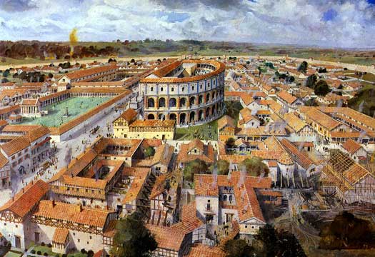
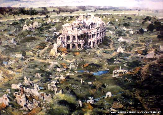
the Roman withdrawal in the early fifth century, the lands of the Votadini became part of the Hen Ogledd, the Old North, which was ruled from Ebrauc (York) by Coel Hen. After the death of Coel Hen in about 420, the Old North gradually splintered into smaller kingdoms. By 470, the Kingdom of Goutodin had 
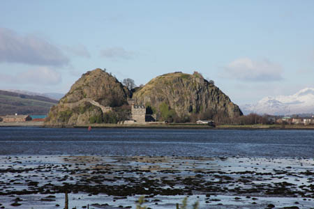
emerged in the northern territory of the Votadini, centred on the citadels of Din Eidyn (Edinburgh) and Trapain Law (Haddington). In the time between Coel Hen’s death and its emergence as an independent kingdom, the Goutodin territory may have been ruled by Alt Clut’s powerful first king, Coroticus, or possibly was governed from Ebrauc by Coel Hen’s successor. The southern half of the Votadini lands became Bernaccia and the border between the two kingdoms was likely at Berwick. To the north was Manau-Gododdin, a small but important sub-kingdom and a buffer against the Picts.

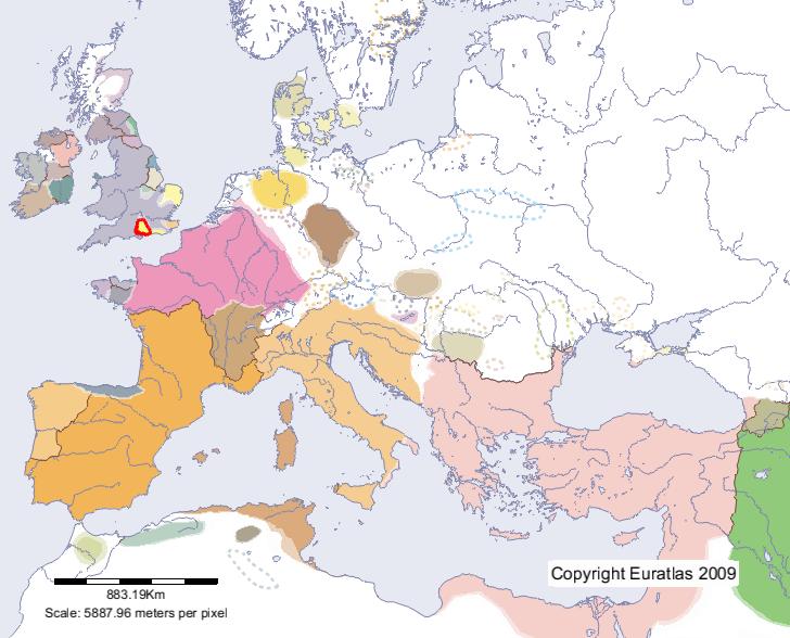
Map showing the Kingdom of Goutodin / Gododdin and its neighbours in c.500
The first king of Goutodin was King Lot, but little is known of his reign in the late fifth century. His son, Gawain, succeeded him in 490 but appears to have been absent from the kingdom for most of his reign as various sources place him first in Rheged and then in Wales. Bran Hen, King of Bernaccia, either took the opportunity and seized Goutodin or was given care of the kingdom by the absent Gawain. Sometime later, Bran Hen handed control of Bernaccia to his young nephew, Morcant Bulc, and kept hold of Goutodin for himself.

In Bernaccia, the Angle laeti revolted in 547, seized the kingdom and kicked Morcant out. The dispossessed king fled north to Goutodin and took refuge in his uncle’s court. Morcant became King of Goutodin after Bran Hen’s death (and presumably in Gawain’s continued absence) but never gave up on regaining his lost kingdom. By 590, Morcant had entered into an alliance with the kings of Alt Clut, Rheged and Elmet, three northern kingdoms who, like Goutodin, felt threatened by the Anglian presence on their borders. The confederation laid siege to Ynys Mencaut (Lindisfarne) the same year and almost succeeded in driving the Bernicians into the sea, but Morcant fatally weakened his own cause by ordering the assassination of King Urien of Rheged. The confederation fell apart, Morcant Bulc disappeared from the records and the Angles regained Bernicia.

The last two British kings of Goutodin, Cynan and Mynyddog Mwynfawr, ruled simultaneously from 590, either as co-rulers, or, more likely, within a divided kingdom with Cynan ruling East Lothian from Trapain Law and Mynyddog Mwynfawr ruling West Lothian from Din Eidyn. The troubled last years of Goutodin are commemorated by a seventh century Welsh poem, Y Gododdin, which records an army of northern warriors from Goutodin, Elmet and Rheged marching south with the intent of retaking Ebrauc from the Angles. Right at the end of the sixth century, in 597, the northern British clashed with a Northumbrian army under Aethelfrith at the Battle of Caltreath (Catterick, in North Yorkshire). The northern British were decimated and Y Gododdin mourns the loss of so many warriors of the Old North. Severely weakened by the defeat, Goutodin managed to limp on for another forty years until 638 when, after King Oswald's capture of Trapain Law and siege of Din Eidyn, Goutodin finally fell to Bernicia.

Monday 7 April 2014

Coroticus of Alt Clut (c.410 - c.450)

The first king of Alt Clut, Coroticus was a powerful Celtic monarch who ruled a considerable swathe of southern Scotland from his base on Dumbarton Rock. The history of Alt Clut during the fifth and sixth centuries is murky at best and what little is known comes from Irish and Welsh sources. Because of this, Coroticus is sometimes referred to as Ceretic Guletic, the Welsh version of his name.

The Harleian genealogies list Coroticus as the son of Cynloup, the grandson of Quintillus and the great-grandson of Clemens. The Roman names of his grandfather and great-grandfather suggest that Coroticus descended from Damnonii leaders who, although they lived some way north of Hadrian’s Wall, were Romanised to some extent. However, Coroticus is a British name and it has been suggested that he was named after Caratacus of the Catuvellauni, a then-legendary leader of a British revolt against the Romans.

Not much is known of his reign in the dark days of sub-Roman Britain. Coroticus was almost certainly the Brittonic warrior addressed in a letter written by St. Patrick. In the letter St Patrick bemoans the capture and enslavement of Irish Christians and their sale to pagans before excommunicating Coroticus and his men. It’s possible that St. Patrick’s letter referred to a bloody raid on Ireland by Coroticus and his men which resulted in the deaths of many Irish, some of which were Christian converts, and others carried back to sell as slaves. Coroticus’s response to the letter, if any, has gone unrecorded.

Stained glass window in Carlow Cathedral, Ireland, showing St. Patrick preaching to the kings.
It’s thought that Coroticus died around 450 and was succeeded either by his son, Cinuit, or possibly his grandson, Dumnagual Hen. His descendants went on to rule kingdoms as far south as the Isle of Man and Alt Clut itself would survive until the late ninth century when Dumbarton would be captured and sacked by the Norse kings of Dublin.

Sunday 6 April 2014

Alt Clut

The Damnonii, a tribe never fully conquered by the Romans, had forged a kingdom by the mid-fourth century in modern day Strathclyde. The kingdom took its name from the Brythonic name of its capital, Alt Clut. Meaning ‘Rock of the Clyde’, the place is now known as Dumbarton. The exact borders of Alt Clut are unclear (and probably shifted regularly) but the kingdom would have bordered Pictland to the north, Goutodin to the east and Caer Guendoleu and Galwyddel to the south.

Map showing Alt Clut and its neighbours in c.700 AD.
For the early part of its history, Alt Clut was an obscure kingdom. What little is known about it comes from odd mentions in Welsh and Irish sources. Only two kings from before the seventh century are known; Coroticus who reigned in the second half of the fifth century and his descendent, Rhydderch Hael, who was king in the late sixth century. Their names suggest Alt Clut, or its ruling nobility at least, was Christian but how this very early Christianisation occurred is unclear and even the life of St Kentigern, Strathclyde’s very own missionary, is shadowy.

The second half of the sixth century was dominated by the loss of Bernaccia to Angle settlers. The dispossessed Morcant Bulc and Rhydderch of Alt Clut formed a coalition with the kings of Elmet and Rheged. This northern British coalition campaigned against the Bernician Angles and laid siege to Ynys Metcaut in 590. The Bernicians were very nearly driven out of the north, but the coalition was fatally weakened by the assassination of Urien of Rheged.

Dumbarton Rock, the 'Rock of the Clyde' that gave its name to the kingdom of Alt Clut.
By 632, the kingdom of Elmet had fallen to the resurgent Bernician Angles. A small enclave managed to survive huddled along Alt Clut’s southern border but the northern Britons no doubt sighed in relief when the Northumbrians turned their attention to southwards expansion. However, the later history of Alt Clut was far from peaceful. There was major conflicts with Dal Riata in 642, 711, and 717. Oengus of Pictland led two campaigns to conquer Alt Clut in the eighth century but was beaten back each time. In 756, the Pictish king teamed up with Eadberht of Northumbria and launched a third attack which very nearly succeeded but both the Picts and the Northumrbrians were almost destroyed in a desperate reversal by Alt Clut. As well as these major events, there were likely numerous smaller battles as the big four northern kingdoms – Alt Clut, Bernicia, Dal Riata and Pictland – squabbled for overlordship of the small, nameless chiefdoms to the south and east.

Very little is heard of Alt Clut until the late ninth century, implying the kingdom enjoyed a period of relative peace. The only mention of Alt Clut in the texts concerns the burning of Dumbarton in 780, but by whom and for what reason are unknown. In 870, Alt Clut was besieged by ‘black pagans’, a Viking army led by Olaf the White and Ivarr the Boneless, Norse kings of Dublin. Dumbarton was destroyed, huge numbers of captives were taken as slaves and the last British king of Alt Clut, Arthgal, was executed. The ruling British dynasty of Alt Clut ended, and the kingdom became a semi-independent territory of the Scots, gradually becoming known as Strathclyde. 

Saturday 5 April 2014

Caer Gloui

Founded by the Romans as Glevum, Caer Gloui was a Romano-British city which would eventually become modern day Gloucester. The city served first as the powerbase for Vortigern in the early fifth century and then as the stronghold of Ambrosius Aurelianus in the battles against the Saxons. Caer Gloui and its sister cities of Caer Baddon and Caer Ceri held out against Saxon advances for over a century but eventually fell to the West Seaxe in 577.

From 420 onwards, Caer Gloui was ruled by semi-independent magistrates, likely Romano-British nobility who gradually gained more autonomy as British central power weakened. Plague and a laeti revolt in the east meant that by the middle of the fifth century, central British authority had collapsed entirely. The magistrate of Caer Gloui, his name lost to history, now commanded much of the area around the Severn Estuary, including the cities of Caer Baddon and Caer Ceri. It is entirely possibly but also completely theoretical that this magistrate was the father of Ambrosius Aurelianus, a later Romano-British king of the region. The name of this territory has also been lost to history but it does appear to have been a cohesive political entity until the mid-fifth century.

Map showing Caer Baddon, Caer Ceri and Caer Gloui. In the mid-sixth century they become separate kingdoms but before that they would have been a single territory administered from Caer Gloui.
In 495, the Britons of Caer Gloui fought and defeated an Anglo-Saxon army led by Aelle of the Suth Seaxe in what proved to be a pivotal battle at Mons Badonicus. Defensive dykes constructed in the mid-fifth century likely channelled the invaders towards Caer Baddon where they were slaughtered in huge numbers. Not surprisingly, the various bands of Saxons, Angle and Jutes that made up Aelle’s army were severely weakened by the defeat and the British won themselves two generations of peace. The aftermath of the battle saw modest increases in the population of Caer Gloui although all of the new building was in wood and large parts of the city had long fallen into disuse.

By the mid-sixth century, the larger territory of Caer Gloui had been split into three kingdoms, probably due to the Celtic practice of dividing a kingdom between sons. This indicates a change from Romanised magistrate rule to true kingship. The three cities, however, remained closely allied and in 556 they fought an army of West Seaxe at Beran byrg (modern day Barbury Castle, near Swindon). The result is unrecorded in the Anglo-Saxon texts so it’s likely it was a British victory.

The British of the three cities and the West Seaxe under Ceawlin met again at the Battle of Deorham in 577. Despite receiving military support from the western kingdoms of Dumnonia and Glastenning, the British were defeated. Caer Gloui’s last king, Conmail, was killed, as were the kings of Caer Baddon and Caer Ceri. Caer Gloui was the last of the three cities to fall, but fall it did. The defeat was a disaster for the British. Gwent and Pengwern were separated from Dumnonia and the already beleaguered Caer Celemion was suddenly exposed on all sides.

The territory was quickly settled by the Hwicce, a mixed band of Angles and Saxons who appear to have merged with the remaining British population. British Christianity certainly survived the influx and it has been suggested that the Hwicce ruled over the Britons rather than eradicating them. The Hwicce who settled around Caer Gloui kept the city’s name but corrupted it into Gleawanceaster. Over time the name would evolve further to become Gloucester.

Friday 4 April 2014

Caer Baddon

Better known by its Roman name of Aqua Sulis, Caer Baddon was a late Romano-British city which would in time become the modern city of Bath. In the early fourth century, the city remained under British central administration but, by 430, Caer Baddon was under the control of the magistrates of Caer Gloui. During this time, it’s likely the British inhabitants of Caer Baddon attempted to maintain an urban Romanised lifestyle but there must have been an inevitable, if slow, decline. The great bath complex eventually fell into disuse although the Britons continued to enjoy the hot springs.

In the early 440s, the city’s Roman defences were repaired but this would be prove to be too little, too late. A serious plague hit southern Britain in 446 and Saxon laeti across the country revolted. Raiders roamed across Britain in a violent free-for-all and attacked any residents who remained. The chaos in Caer Baddon is perhaps best illustrated by the discovery of a severed skull of a young child found in an oven of a Roman townhouse in the city.

The chaos reaches its zenith when Aelle and his confederation of Angles, Jutes and Saxons marched west in 496. The Britons and invaders clashed at the Battle of Mons Badonicus which, although the exact location is unknown, was likely fought at or near Caer Baddon. The British claimed a decisive victory, and secured themselves two generations of peace.

Badbury Rings, in Dorset - a possible location for the Battle of Mons Badonicus
In the mid-sixth century, the single territory of Caer Gloui was split into three kingdoms, of which Caer Baddon was one. This probably reflected a Celtic practice of dividing a kingdom between sons; an interesting shift from the previous Roman-style administration. The city was protected to the south-west by the Wansdyke, a huge earthwork constructed either in anticipation of the Battle of Mons Badonicus, or just after. However, the West Seaxe under Ceawlin managed to break through in 577 and, despite military support from Glastenning and Dumnonia, the British were defeated at the Battle of Deorham. Caer Baddon’s last king, Farinmail, was killed fighting the West Seaxe, as were the kings of Caer Ceri and Caer Gloui.

The defeat was a disaster for the British. Caer Baddon fell to the West Seaxe, swiftly followed by Caer Ceri and Caer Gloui. Caer Celemion was exposed on all sides and the British kingdoms of Gwent and Pengwern were separated from Dumnonia in the west. The kingdoms of Dumnonia and Glastenning, safe behind the Wansdyke, kept hold of what they could of Caer Baddon’s territory but the remainder was quickly settled by Angles, who migrated into the northern parts of the kingdom, and Saxons, who settled around Gloucester and Bath. The Saxons kept the city name but corrupted it to Bathanceaster. It remained an important religious site and a Saxon monastery was founded in the city in the seventh century. The Saxon and Angle settlers became collectively known as the Hwicce.

Thursday 3 April 2014

Caer Gwinntguic

A very early fifth century British kingdom, Caer Gwinntguic evolved from the pre-Roman territory of the Belgae tribe. Centred on the Roman town of Venta Belgarum, the kingdom was tasked with defending the westernmost section of the Saxon Shore. In the face of increasing barbarian raids, laeti from North Germany, most likely Saxons, were settled along the south coast. Meonware Jutes also settled along the coast, potentially threatening the kingdom’s southern borders, but peaceful relations appear to have been quickly established. Of greater concern was Aelle and the Suth Seaxe who had landed on the south coast in 477.

From its very beginnings, Caer Gwinntguic was on a defensive footing, likely due to the collapse of Rhegin to the southeast, the expansion of the Suth Seaxe and the emerging West Seaxe kingdom under Cerdic. In the mid-fifth century, there was a widespread laeti revolt, triggered by a plague that swept across southern Britain and a vicious power struggle within the British administration. However, it seems that many of the laeti of Caer Gwinntguic remained loyal and fought alongside their Romano-British neighbours right up until the kingdom’s dying days in the late sixth century. As a result, the archaeology of Caer Gwinntguic reveals a blend of cultures and people, perhaps best illustrated by the kingdom’s name itself; ‘Gwinntguic’ is likely a Saxon corruption of a Celtic name which was later adopted by the British.

In 508, the Saxon and Romano-British warriors of Caer Gwinntguic were led by a chief by the name of Natanlaod to meet the West Seaxe in battle somewhere near Southampton Water. Cerdic’s West Seaxe took victory and, as a result, Caer Gwinntguic was completely isolated from the south coast it was supposed to protect. Fifty years later, the kingdom fell to the West Seaxe, leaving its northern neighbour, Caer Celemion, exposed and vulnerable. The city of Venta Belgarum was not fully abandoned, however, and it is likely that a small number of surviving Saxon laeti and Romano-Britons eked out a living in the ruins. Perhaps because it was not fully abandoned, Venta Belgarum would later be revived as Wintanceastre, the capital of Wessex.

Wednesday 2 April 2014

Thames Valley Saxons

The Thames Valley Saxons were some of the first Saxon groups to arrive in England but the efforts of these early settlers have gone largely unrecorded. Archaeological evidence suggests that by the start of the fifth century, small groups of Saxons had settled in the Thames Valley, probably employed as laeti to defend the borders of the various British territories which had sprung up in the region. Pagan cemeteries found at the confluence of the Thames and Kennet rivers, dating to the late fifth century, give testament to this very early Saxon settlement. In many ways the Thames Valley Saxons were trailblazers and many later settlers would follow in their footsteps

It appears that the Saxon laeti remained loyal to their Romano-British masters until around 440 AD. Some laeti, such as those in Caer Gwinntguic, remained loyal and threw in their lot with the native British population. Others, however, started to carve out their own chiefdoms in the Thames Valley as British influence weakened in the face of a plague which swept across southern Britain in the mid-fifth century. Bands of Thames Valley Saxons were threatening the northern border of Caer Celemion by 470 and twenty years later were starting to encroach on the territory of Cynwidion. By the end of the fifth century, Thames Valley Saxons had wrested control of the Upper Thames Valley from the Britons.

A map showing the Thames Valley. The Thames Valley Saxons would have migrated from east to west, as would many other later settlers.
As Aelle, King of the Suth Seaxe and Bretwalda, marched northwards along the Thames Valley to do battle with the Britons at Caer Baddon, it is very likely that bands of Thames Valley Saxons were involved in the heavy defeat at Mons Badonicus in 496. It is also very likely that the Thames Valley Saxons, along with the Suth Seaxe and Cantware, were severely weakened in the aftermath of the battle and there were no more major Saxon advances for a generation. Instead, the British may have actually regained part of the Thames Valley although they didn't keep hold of any regained land for long.

By the mid-sixth century, the Thames Valley Saxons appear to have recovered sufficiently to pose a threat to both the Romano-Britons of Caer Celemion and Caer Ceri and the West Seaxe. At that time, Ceawlin of the West Seaxe led a series of campaigns along the Thames Valley but it was his successors, Ceol and Ceolwulf, who established firm control. By 592, any independence the Thames Valley Saxons once had was gone.

It has been suggested that the Thames Valley Saxons who migrated westwards may have become the Gewisse, a mixed Saxon and Angle tribe who settled around Gloucestershire and Worcestershire. In time the Gewisse became the very first West Saxons. This, however, remains nothing more than a theory.

Tuesday 1 April 2014

Venta Belgarum

Established in 70 AD on the site of an abandoned Iron Age hill fort, Venta Belgarum was the civitas of the Celtic Belgae tribe whose territory covered much of modern-day Hampshire. Venta Belgarum was a thriving and prosperous Romano-British town.  A defensive earth bank and ditch encircled the city by the second century, and stone city walls were erected a century later. Excavations have shown that Venta Belgarum had many fine Roman townhouses complete with mosaics, large public buildings and temples dedicated to the Roman gods Jupiter, Juno and Minerva as well as the Celtic horse goddess, Epona. Outside of the city walls were extensive suburbs and two large Romano-British cemeteries to the north and east.

Mosaic floor from a nearby Roman villa
Venta Belgarum did not escape the general decline suffered by Roman Britain in the fourth century. Houses started to fall into disrepair and the drainage system collapsed.  Testament to the increasing threat of raids by Germanic war bands, the city’s defences were strengthened and there is archaeological evidence of laeti, South German mercenaries who helped defend Venta Belgarum in return for land outside the city.
By the early fifth century, Venta Belgarum had become the regional capital of Caer Gwinntguic, a sub-Roman British kingdom tasked with defending the westernmost portion of the Saxon Shore. The 420s and 430s saw a second settlement of laeti, this time from North Germany and almost certainly Saxons. Jutish settlement on the eastern side of Southampton Water posed a potential threat but peaceful relations were quickly established, possibly due to the newcomers’ integration with long-settled laeti.

Map of Europe in 500 AD. Venta Belgarum / Caer Gwinntguic is outlined in red.
By 477, the arrival of Saxon settlers under Aelle at Selsey in modern day West Sussex had largely cut off Venta Belgarum from the south coast. The city’s population had dwindled and economic activity had all but ceased. Over the next fifty years, the few inhabitants of Venta Belgarum must have developed a siege-like mentality in the face of Saxon encroachment from the east. The city’s south gate was blocked in two stages, probably in response to the founding of a nascent West Saxon kingdom under Cerdic, an act that likely forced Cerdic to advance instead towards the less well-defended West Country.

By the early 6th century, Venta Belgarum was very isolated indeed. Rhegin to the south-east had fallen to Aelle of the Suth Seaxe and it was cut off from Dumnonia in the west. The remaining population was likely made up of equal amounts of Romano-Britons and Saxon laeti who, having been settled in Britain for several generations, had more in common with the native population than the invaders.

In 508, the Romano-Britons of Caer Gwinntguic were defeated in battle by the West Seaxe under Cerdic and became completely cut off from the south coast. Fifty years later the kingdom collapsed and the city itself fell to the West Seaxe. The population dwindled even further but it's thought that Venta Belgarum was not fully abandoned. The few Saxon descendents of long-ago laeti probably remained, as did any surviving Romano-Britons. Probably because the city was never fully abandoned, it was revived in the late 6th century and became known as Wintanceastre, capital of the West Seaxe kingdom.